En
Log in
All resources
Create a design
Tools
7,170 Free Images of Atlas Map
joan blaeu
copper engraving print
british library
nieuwe en beknopte hand-atlas (1754)
atlas maior, vol 3 (germany) - joan blaeu, 1667 - bl 114.h(star).3
beschreibung und contrafactur der vornembster stät der welt, liber primus civitates orbis terrarum
gemeente atlas van nederland - north holland
1860s maps of north holland
atlas des anciens plans de paris by imprimerie nationale, 1880 from bhvp
national library of poland
nieuwe en beknopte hand-atlas (1754)
gemeente atlas van nederland - gelderland
old maps of wageningen
media from regionaal archief alkmaar
scharwoude
atlas des anciens plans de paris by imprimerie nationale, 1880 from bhvp
map of paris by jouvin de rochefort (boutier 112)
atlas des anciens plans de paris by imprimerie nationale, 1880 from bhvp
18th-century maps of paris
maps of paris from paris musées
baroque
media from atlas of mutual heritage on dutch east india company
portolan charts by willem and johannes blaeu
gemeente atlas van nederland - north holland
old maps of hoorn, north holland
maps of île-de-france by françois de la guillotière
atlas minor gerardi mercatoris (1621, maps)
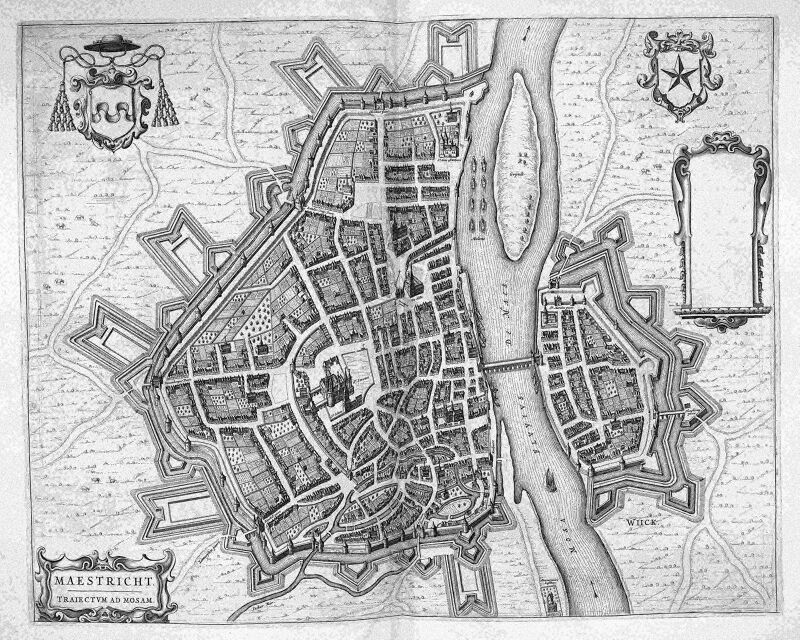
map of maastricht by willem and johannes blaeu (1649)
atlas beudeker
old maps of swabia
maps by john cary
gemeente atlas van nederland - south holland
maps of koudekerk aan den rijn
liber qvartvs contrafactur vnd beschreibung von den vornembsten stten der welt (zzk 0.32)
patrimonium 2 (project)
atlas maior, vol 2 (sweden, russia, poland, eastern europe, and greece) - joan blaeu, 1667 - bl 114.h(star).2
copper engraving print
atlas maior, vol 3 (germany) - joan blaeu, 1667 - bl 114.h(star).3
copper engraving print
atlas maior, vol 1 (northern europe, norway, and denmark) - joan blaeu, 1667 - bl 114.h(star).1
copper engraving print
atlas maior, vol 3 (germany) - joan blaeu, 1667 - bl 114.h(star).3
copper engraving print
atlas maior, vol 2 (sweden, russia, poland, eastern europe, and greece) - joan blaeu, 1667 - bl 114.h(star).2
copper engraving print
atlas maior, vol 4 (netherlands) - joan blaeu, 1667 - bl 114.h(star).4
copper engraving print
atlas maior, vol 3 (germany) - joan blaeu, 1667 - bl 114.h(star).3
copper engraving print
atlas maior, vol 3 (germany) - joan blaeu, 1667 - bl 114.h(star).3
copper engraving print
atlas maior, vol 3 (germany) - joan blaeu, 1667 - bl 114.h(star).3
copper engraving print
atlas maior, vol 2 (sweden, russia, poland, eastern europe, and greece) - joan blaeu, 1667 - bl 114.h(star).2
copper engraving print
atlas maior, vol 3 (germany) - joan blaeu, 1667 - bl 114.h(star).3
copper engraving print
atlas des anciens plans de paris by imprimerie nationale, 1880 from bhvp
dheulland map of paris
atlas maior, vol 4 (netherlands) - joan blaeu, 1667 - bl 114.h(star).4
copper engraving print
atlas maior, vol 3 (germany) - joan blaeu, 1667 - bl 114.h(star).3
copper engraving print
atlas maior, vol 3 (germany) - joan blaeu, 1667 - bl 114.h(star).3
copper engraving print
atlas maior, vol 1 (northern europe, norway, and denmark) - joan blaeu, 1667 - bl 114.h(star).1
copper engraving print
atlas maior, vol 3 (germany) - joan blaeu, 1667 - bl 114.h(star).3
copper engraving print
atlas maior, vol 3 (germany) - joan blaeu, 1667 - bl 114.h(star).3
copper engraving print
atlas maior, vol 1 (northern europe, norway, and denmark) - joan blaeu, 1667 - bl 114.h(star).1
copper engraving print
atlas maior, vol 1 (northern europe, norway, and denmark) - joan blaeu, 1667 - bl 114.h(star).1
copper engraving print
atlas maior, vol 3 (germany) - joan blaeu, 1667 - bl 114.h(star).3
copper engraving print
atlas maior, vol 2 (sweden, russia, poland, eastern europe, and greece) - joan blaeu, 1667 - bl 114.h(star).2
copper engraving print
civitates orbis terrarvm, liber primvs (1577)
maps of munich by braun & hogenberg
liber qvartvs contrafactur vnd beschreibung von den vornembsten stten der welt (zzk 0.32)
patrimonium 2 (project)
nieuwe en beknopte hand-atlas (1754)
nieuwe en beknopte hand-atlas (1754)
nieuwe en beknopte hand-atlas (1754)
nieuwe en beknopte hand-atlas (1754)
map of maastricht by willem and johannes blaeu (1649)
meuse river in maastricht
maps of helsingborg by braun & hogenberg
vrbivm praecipvarvm totivs mvndi (1612)
media from regionaal archief alkmaar
egmond-binnen
atlas des anciens plans de paris by imprimerie nationale, 1880 from bhvp
map of paris by jouvin de rochefort (boutier 112)
old maps of ukraine
atlas novus (blaeu)
atlas sive cosmographicae (gerardus mercator, 1630)
maps of corsica by gerardus mercator
atlas sive cosmographicae (gerardus mercator, 1630)
maps of england by gerardus mercator
vrbivm praecipvarvm totivs mvndi (1612)
maps of dokkum by braun & hogenberg
vrbivm praecipvarvm totivs mvndi (1612)
maps of bolsward by braun & hogenberg
gemeente atlas van nederland - south holland
1860s maps of south holland
beschreibung und contrafactur der vornembster stät der welt, liber primus civitates orbis terrarum
panoramic maps of seville by braun & hogenberg
atlas - voyage pittoresque à l'île-de-france, au cap de bonne-espérance et à l'île de ténériffe (1812) by milbert
maps from the mechanical curator collection
1830s maps of the world
maps by daniel lizars
atlas schoemaker-friesland
maps of dantumadiel
gemeente atlas van nederland - north holland
old maps of beverwijk
august kneisel
atlases
atlas des anciens plans de paris by imprimerie nationale, 1880 from bhvp
proletarian literature
maps from university of amsterdam special collections
atlas der neederlanden
nieuwe en beknopte hand-atlas (1754)
nieuwe en beknopte hand-atlas (1754)
nieuwe en beknopte hand-atlas (1754)
maps from university of amsterdam special collections
atlas der neederlanden
nieuwe en beknopte hand-atlas (1754)
nieuwe en beknopte hand-atlas (1754)
nieuwe en beknopte hand-atlas (1754)
nieuwe en beknopte hand-atlas (1754)
nieuwe en beknopte hand-atlas (1754)
media from regionaal archief alkmaar
zuidschermer
gemeente atlas van nederland - zeeland
kreekrakdam
media from regionaal archief alkmaar
sint pancras
old maps of north rhine-westphalia
atlas novus (blaeu)
old maps of south holland
atlas novus (blaeu)
jaume ferrer (sailor)
catalan atlas
map of maastricht by willem and johannes blaeu (1649)
jezuïetenwal (maastricht)
gemeente atlas van nederland - south holland
1860s maps of south holland
blaeu atlas of scotland 1654
timothy pont
maps from university of amsterdam special collections
atlas der neederlanden
maps from university of amsterdam special collections
atlas der neederlanden
maps from university of amsterdam special collections
atlas der neederlanden
gemeente atlas van nederland - north brabant
mill, netherlands
maps by john cary
1799 maps
beschreibung und contrafactur der vornembster stät der welt, liber primus civitates orbis terrarum
maps of hormuz by braun & hogenberg
beschreibung und contrafactur der vornembster stät der welt, liber primus civitates orbis terrarum
maps of munich by braun & hogenberg
beschreibung und contrafactur der vornembster stät der welt, liber primus civitates orbis terrarum
maps of weimar by braun & hogenberg
beschreibung und contrafactur der vornembster stät der welt, liber primus civitates orbis terrarum
maps of aden by braun & hogenberg
beschreibung und contrafactur der vornembster stät der welt, liber primus civitates orbis terrarum
maps of parma by braun & hogenberg
beschreibung und contrafactur der vornembster stät der welt, liber primus civitates orbis terrarum
maps of tangier by braun & hogenberg
beschreibung und contrafactur der vornembster stät der welt, liber primus civitates orbis terrarum
maps of salzburg by braun & hogenberg
atlas maior, vol 1 (northern europe, norway, and denmark) - joan blaeu, 1667 - bl 114.h(star).1
1667 maps
atlas maior, vol 1 (northern europe, norway, and denmark) - joan blaeu, 1667 - bl 114.h(star).1
1667 maps
maps in the library of congress
1830s maps of china
atlas des anciens plans de paris by imprimerie nationale, 1880 from bhvp
map of paris by françois quesnel
nieuwe en beknopte hand-atlas (1754)
atlas sive cosmographicae (gerardus mercator, 1623)
mercator 1587 world map
atlas sive cosmographicae (gerardus mercator, 1623)
maps of bourgogne (duchy) by gerardus mercator
atlas sive cosmographicae (gerardus mercator, 1623)
maps of guinea by mercator-hondius
atlas sive cosmographicae (gerardus mercator, 1623)
maps of emilia-romagna by gerardus mercator
atlas sive cosmographicae (gerardus mercator, 1623)
maps of europe by mercator-hondius
atlas sive cosmographicae (gerardus mercator, 1623)
maps of south asia by mercator-hondius
3101 - 3200 of 7,170
Next page
/ 72